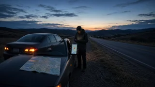
Find your current GPS coordinates to report a breakdown

When your vehicle breaks down somewhere without an obvious address, the most precise thing you can give a dispatcher or roadside assistance provider is your latitude and longitude. A smartphone can show these numbers in a few taps, even when no street address is nearby. This guide explains where to find them, which format to read out, and which roadside details make them more useful.
The short answer
Open a maps app on your phone, center it on the dot that marks your current position, and drop a pin on that spot. The app will display the pin's coordinates as two numbers: latitude (north–south position) and longitude (east–west position). On an iPhone, the built-in Compass app also shows your coordinates. Read both numbers to the person helping you, along with your road name, direction of travel and the nearest mile marker or exit.
One qualification changes the priority: if anyone is injured, the vehicle is in a live traffic lane, or you feel unsafe, call 911 first. Wireless carriers can pass location information to 911 call centers, but how precise that information is depends on the phone, the carrier and the conditions. Coordinates you read out are a useful backup, not a reason to delay the call.
Finding your coordinates in Google Maps
Google Maps does not always show coordinates for the blue location dot directly, so the usual method is to drop a pin on your position. The exact taps can differ between app versions and between Android and iPhone, but the general process is the same.
Make sure location services are turned on for the phone and for Google Maps. Tap the location button so the map centers on the blue dot that marks where you are. Touch and hold the map directly on or next to the blue dot until a red pin appears. On Android, the coordinates usually appear in the search box at the top of the screen. On iPhone, swipe up on the information card at the bottom of the screen; the coordinates are typically listed there. Tap the coordinates to copy them if you want to paste them into a text message.
Because the pin goes where your finger lands, zoom in before pressing so it sits as close to the blue dot as possible. The coordinates belong to the pin, not to the dot itself.
Other ways to find exact coordinates on a phone
On an iPhone, the Compass app shows your latitude and longitude near the bottom of the screen once location access is allowed. This is often the fastest option because there is no pin to place. Apple Maps can also show coordinates: tap your location dot or drop a pin, then look at the details card that opens.
Many phones also include an emergency SOS feature that can call emergency services and share your location with designated contacts. How it is triggered and what it sends varies by manufacturer and software version, so check your phone's settings or documentation before you need it.
Decimal degrees vs. DMS: which format to give
Coordinates appear in two common formats. Decimal degrees (DD) express each value as a single number with decimals, and most phone map apps show this format by default. Degrees, minutes and seconds (DMS) split each value into three parts, the way coordinates are traditionally written on charts. Both describe the same point. Give the format your phone shows unless the person helping you asks for the other one.
Decimal degrees (DD): latitude, longitude e.g. DD.dddddd, -DDD.dddddd; Degrees, minutes, seconds (DMS): DD° MM' SS.S" N, DDD° MM' SS.S" W
If you need DMS but only have decimal degrees, the conversion is straightforward. The whole number is the degrees. Multiply the remaining decimal part by 60; the whole number of that result is the minutes. Multiply the leftover decimal by 60 again to get the seconds. A positive latitude is north and a negative latitude is south; a positive longitude is east and a negative longitude is west.
Reading coordinates aloud without errors
A small mistake when reading coordinates aloud can move the reported location a long way, so it's worth reading them slowly and carefully.
Say latitude first, then longitude, and name each one so there is no mix-up. Keep the minus sign or the direction letter. In the contiguous United States, latitude is north (positive) and longitude is west (negative in decimal format). Dropping the minus sign places you on the other side of the world. Read every digit after the decimal point instead of rounding; each extra decimal place narrows down the location. Read digits one at a time, and ask the dispatcher to repeat the numbers back to you. If you can send a text, paste the copied coordinates so the recipient does not have to transcribe them.
Roadside cues that back up the numbers
Coordinates tell responders where you are, but not which side of a divided highway you are on or how to reach you. Pair them with details you can see from the vehicle.
Road or highway name and number. Direction of travel, such as northbound or westbound. The nearest mile marker, usually a small numbered post or sign along the shoulder. The last exit you passed or the next one ahead, by number or name. Whether you are on the shoulder, the median, a ramp or a side road. Visible landmarks, such as a bridge, overpass, rest area or business sign. A short description of the vehicle: color, body style and make.
Using your vehicle's built-in systems
Some vehicles have a factory navigation screen that can display coordinates, or a connected-services system with an assistance or SOS button that sends the vehicle's location to a call center. Whether your vehicle has these features, where the button is located, and whether the service requires an active subscription all depend on the make, model year, trim and market. Check the owner's manual or the connected-services documentation for your vehicle's configuration rather than assuming a feature is there.
When the coordinates may be unreliable
Phone GPS works best with a clear view of the sky. Accuracy can drop in tunnels, deep cuts, dense tree cover, parking structures and areas surrounded by tall buildings. The GPS receiver itself does not need mobile data, but without a data connection the map tiles may not load and the first position fix can take longer. If the location circle around your dot is large, or the dot is moving while you are stopped, give the coordinates anyway but rely more heavily on mile markers and landmarks, and tell the dispatcher the position may be approximate.
What this guide does not cover
No source-specific data was available for this article, so it gives no accuracy figures for particular phones or apps, no carrier-specific details about how 911 location works, and no list of vehicles with built-in SOS or coordinate displays. Menu names and steps in map apps change between software versions. Before you travel, open your preferred app and confirm where your coordinates appear, so you already know the steps if you break down.