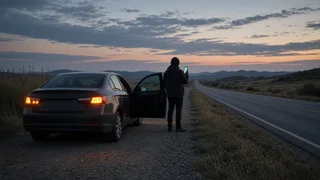
How to Find Your Current Location for Roadside Assistance
The Short Answer
The fastest way to check your location after a breakdown is to open the map app on your smartphone, tap the button that centers the map on you, and read the street address or GPS coordinates it shows. Then confirm that position with something you can see, such as a highway mile marker, an exit number, a cross street or a business name. Give the roadside assistance dispatcher both the digital position and the physical cues, because either one alone can be wrong or incomplete.
GPS (Global Positioning System) coordinates are two numbers, latitude and longitude, that pinpoint a spot on the earth. They are the most precise way to describe where you are when there is no clear street address, such as on a rural highway or an unmarked road. One condition changes the advice: if anyone is injured, the vehicle is in a dangerous spot, or there is a fire or traffic hazard, call 911 first. Emergency calls in the US can often pass your phone's location to the dispatcher automatically, but you should still be ready to describe where you are.
Before You Start: Get to a Safer Position
Finding your location only matters once you and your passengers are as safe as the situation allows. Turn on your hazard lights. If the vehicle can still move, steer it onto the shoulder, an exit ramp or a parking area, as far from moving traffic as possible. On a busy highway, it is generally safer to stay buckled in the vehicle or to move well away from the road behind a barrier than to stand beside the car. Do not walk along live traffic lanes to read a sign. If you cannot get to safety, call 911 instead of a roadside assistance line.
Method 1: Check Your Location on a Smartphone Map
Most phones include a built-in map app, and many drivers also use a third-party navigation app. Menu names and button positions change between app versions, so treat the steps below as a general pattern rather than an exact script.
1) Make sure location services are turned on in your phone's settings. If they are off, the map cannot show where you are. 2) Open your map or navigation app. 3) Tap the location button, usually an arrow or a crosshair icon, to center the map on your position. Your location typically appears as a blue dot. 4) Tap the blue dot, or press and hold on it, to open a card that may show the nearest address, the road name and options to share your location. 5) If the app shows an accuracy circle around the dot, note its size. A large circle means the phone is unsure of your exact position; wait a moment or move to a spot with a clearer view of the sky if it is safe to do so. 6) Write down or screenshot the address, road name and any nearby landmarks the map displays.
An address shown by a map app is an estimate based on the nearest known property. On highways and rural roads it may point to a house or business some distance away from where your car actually sits. That is why coordinates and physical markers are worth adding.
Method 2: Get Your GPS Coordinates
Coordinates are useful when there is no reliable address. There are several common ways to see them on a phone:
Map app pin: In many map apps, pressing and holding on your blue dot or a spot on the map drops a pin and displays the latitude and longitude, often in the search bar or in the pin's information card. Compass app: On iPhones, the built-in Compass app shows your current coordinates on screen. Some Android phones include a similar compass or GPS tool. Location-sharing feature: Many map and messaging apps can send your current position as a link or pin that the recipient opens on their own map. Some roadside assistance apps and insurer apps also send your position automatically when you request help. Dedicated coordinate apps: Various apps act as a location finder or GPS display and show coordinates in large text that is easy to read aloud.
Coordinates appear in two common formats. Decimal degrees look like a pair of numbers with decimal points, for example 39.12345, -104.67890. Degrees, minutes and seconds use symbols and letters, for example 39° 7' 24" N, 104° 40' 44" W. Both describe the same kind of position; just read whichever format your phone shows, exactly as displayed.
Decimal degrees: 39.12345, -104.67890; Degrees, minutes, seconds: 39° 7' 24" N, 104° 40' 44" W; (Example values only; read your own screen.)
Tips for reading coordinates aloud: Say latitude first, then longitude. In the contiguous US, latitude is north (positive) and longitude is west, which appears as a negative number in decimal format. Include the minus sign or the letter W when you read it. Read every digit after the decimal point. Dropping digits can move the position by a meaningful distance. Ask the dispatcher to repeat the numbers back to you.
Method 3: Use Road Signs and Physical Landmarks
Physical cues confirm what your phone says and work even if your battery is low or the signal is poor. Look for these, ideally from inside the vehicle or from a safe position:
Mile markers: Small vertical signs along many US highways, often green with white numbers, that count miles along that route within a state. Note the number and the highway name. Reference location signs: On some highways, smaller signs placed at shorter intervals between mile markers show the route and a more precise position, such as a number with a decimal. If you see one, read it exactly. Exit numbers: On many interstates, exit numbers are tied to the nearest mile marker. Note the last exit you passed and the next one ahead. Direction of travel: State whether you are heading northbound, southbound, eastbound or westbound, or name the city you were driving toward. On a divided highway, this tells the tow truck which side of the road you are on. Cross streets and intersections: In towns and cities, the two nearest street names are often more useful than an approximate address. Landmarks: Business names, bridges, overpasses, rest areas, water towers, distinctive buildings or signs naming a town limit. Roadside callbox numbers: Where callboxes still exist, each one usually carries an identifying number.
Watch for look-alikes. A route number on a shield sign is not a mile marker, and a speed limit sign is not an exit number. If you are on a highway with both a local name and a route number, give both. If you are unsure which highway you are on, check the last route shield you saw or the road name shown in your map app.
Method 4: Use Your Vehicle's Built-In Systems
Some vehicles have connected services or a built-in emergency or assistance button, often on the overhead console or rearview mirror area. Depending on the manufacturer, model year, trim and whether the subscription is active, pressing it may connect you to an operator who can see the vehicle's GPS position. A factory navigation screen may also display your current location or coordinates. Availability varies widely, so check your owner's manual or the vehicle's settings menu if you are not sure what your car offers. Do not count on these features if you have never confirmed they are active.
What to Do with No Cell Signal or a Low Battery
Your phone's GPS receiver does not need cellular data to determine your position. Without a signal, a map app may fail to load map images, but a compass or coordinate display can often still show latitude and longitude. Write the coordinates down on paper so you have them if the phone dies.
Lower screen brightness and close unnecessary apps to save battery. Charge the phone from the vehicle if the electrical system still works. Try a text message if a call will not connect; texts sometimes get through on a weak signal. Text-to-911 is available in many US areas but not everywhere. Some newer phones offer emergency messaging via satellite when there is no cellular coverage. Check whether your device supports this before you need it. If you must move to find a signal, do so only if it is safe, and note where you left the vehicle.
How to Give Your Location to the Dispatcher
Have the information ready before you call so you can give it clearly in one go. A complete location report usually includes:
Highway or road name and route number; Direction of travel; Nearest mile marker, reference sign or exit number; Nearest cross street, town or landmark; GPS coordinates from your phone; Which side of the road you are on, and whether you are on the shoulder, median, ramp or in a travel lane; Vehicle description: color, make, model and anything distinctive
If the service offers to send you a text link that shares your location, accept it, but still describe your position verbally. Automatic location data can be off, especially near overpasses, in tunnels, in dense urban areas or in mountainous terrain.
Check That Your Location Was Received Correctly
Before ending the call, ask the dispatcher to read your location back to you. Confirm the highway, the direction of travel and the mile marker or cross street. If they mention a town or exit that does not match what you see, correct it right away. If the service sends a tracking link or an estimated arrival time, open it and verify that the pin on their map matches your blue dot. Keep your phone on and nearby so the driver can call if they cannot find you, and if your vehicle moves or you relocate to a safer spot, update the service with your new position.
Prepare Before Your Next Trip
Practice finding your coordinates on your phone now, so you know where they appear. Keep location services enabled for your map app. Save your roadside assistance number and any related app on your phone, and keep the number on paper in the glovebox. Learn whether your vehicle has an active assistance or emergency button. Carry a phone charging cable that works in your car. On long or remote drives, glance at mile markers and exit numbers occasionally so you have a rough idea of your position even before you stop.