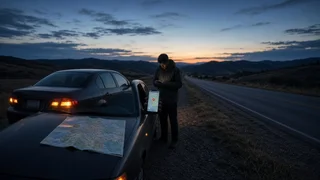
How to Find Your Location After a Breakdown
After a breakdown, the fastest way to find your location is to open a map app on your smartphone and tap the blue dot that marks your position. Most map apps then show your street address, your GPS coordinates, or both. If your phone cannot get a fix, you can still describe where you are using the road name, direction of travel, mile markers, exit numbers and nearby landmarks. A useful report includes coordinates or an address and a plain-language description, because each covers gaps in the other. Two terms come up throughout this guide. Coordinates are latitude and longitude, the two numbers that pinpoint a spot on Earth regardless of whether it has a street address. Position accuracy is how close your device's reported location is likely to be to where you actually are. Accuracy changes with signal conditions, so the steps below include ways to check it.
Before You Look: Get Somewhere Safe
Finding your location can wait until the vehicle is as far from traffic as possible. Turn on your hazard lights first. If you are on a highway shoulder and it is safe to leave the car, stand well away from traffic, behind a barrier if there is one. If leaving the car is not safe, stay inside with your seat belt on. If anyone is hurt, the vehicle is in a traffic lane, or there is smoke or fire, call 911 immediately. Dispatchers can help you work out your location during the call.
Ways to Find Where You Are
Method | What it needs | What it gives you | Main limitation; Map app on your phone | Location services turned on and a GPS fix | Address, coordinates, a map view | Maps may not load without a data connection; Phone compass or coordinate app | Location services and a GPS fix | Coordinates | Often no street address; Browser-based location page | Internet connection and browser location permission | Approximate position or coordinates | Can be inaccurate on a laptop or desktop; In-vehicle navigation screen | A car with built-in navigation | Current road, sometimes coordinates | Varies by model; map data may be outdated; Connected-vehicle assistance button | A vehicle with an active connected service | Location sent automatically to an operator | Only on equipped vehicles with a working subscription; Roadside cues | Your own observation | Road, direction, mile marker, exit, landmarks | Takes care to describe accurately
Find Your Exact Location on a Smartphone
The exact menu names vary by phone model, operating system version and app, but the general process is the same on iPhone and Android.
1) Confirm that location services are on in your phone's device settings. Also confirm that your map app is allowed to use your location, ideally with precise location enabled. 2) Open your map app and tap the button that centers the map on your position. Your location appears as a dot, usually blue. 3) Look at the shaded circle around the dot. A small circle means good position accuracy. A large circle means the phone is estimating. 4) Tap the dot, or press and hold on it, depending on the app. A panel usually shows your address, coordinates, or both. 5) If you see an address but no coordinates, press and hold on the map exactly at your dot. Many apps drop a pin and show the coordinates of that spot. 6) Copy the coordinates, or note them carefully in writing, before you make a call.
Some phones offer a second route to coordinates. On iPhone, the built-in Compass app has typically displayed latitude and longitude at the bottom of the screen when location access is allowed. On Android, the coordinates are usually easiest to get by dropping a pin in the map app. Both use the phone's GPS receiver, which can work without a cellular data connection. In areas with no service, they may still give you coordinates even when the map itself will not load.
Find Your Location Online
Web map services and location-lookup pages can find your location in a browser. When the page asks for permission to use your location, you need to allow it. If you blocked the request earlier, open your browser's site settings and change the location permission for that page.
On a phone, a browser can usually use the device's GPS and give a reasonably accurate result. On a laptop or tablet without GPS, the browser estimates your position from nearby Wi-Fi networks or your internet connection. That estimate can be off by a wide margin, so do not rely on it for roadside help unless you have checked it against signs or landmarks.
Use Your Car's Built-In Systems
If your phone is dead or has no signal, check the vehicle itself. Many cars with factory navigation show the current road name, and some can display coordinates in a location or information menu. The menu path depends on the make, model year and infotainment system, so check the owner's manual for your specific vehicle if you cannot find it.
Some vehicles have an assistance or SOS button, often on the overhead console or rearview mirror, that connects to a service center. On equipped vehicles with an active service, this can send your position to the operator automatically. Whether your car has this feature, and whether it is active, depends on the model, the trim and your subscription status.
Read the Road When Technology Fails
Roadside cues can pin down your location well enough for help to find you. Look for the following:
Road name or highway number, including the route designation such as interstate, US route or state route; Direction of travel, which you can read from route signs such as northbound or eastbound; Mile markers, the small numbered signs along many highways, along with the nearest number you passed; The last exit you passed and the next one ahead, including exit numbers or names; Cross streets, intersections, bridges, overpasses, rest areas, toll plazas or construction zones; Nearby businesses, buildings or other landmarks that stand out; Which side of the road you are on, and whether you are on the shoulder, in the median or on a ramp; Your route information, such as the town you left and roughly how long ago, if you are unsure of anything else
On a divided highway, direction matters as much as the mile marker. A tow truck sent to the wrong side may need to travel to the next interchange to turn around.
How to Read and Share Coordinates
Coordinates appear in two common formats. Decimal degrees are easiest to read aloud and paste. Degrees, minutes and seconds are an older format that some devices still show. Either one works, as long as you give both numbers in full and in the right order: latitude first, then longitude. The examples below show the layout only and do not represent a real location.
Decimal degrees: DD.DDDDDD, -DDD.DDDDDD; Degrees, minutes, seconds: DD° MM' SS.S" N DDD° MM' SS.S" W
In the United States, latitude is a positive number (north) and longitude is a negative number (west). If you read decimal coordinates aloud, include the minus sign on the longitude, or say "west." If you drop the sign, the coordinates point to the opposite side of the world. If you can, text the coordinates instead of reading them out. That avoids transcription mistakes.
What to Tell Roadside Assistance or 911
When you call, give your location in this order so the dispatcher gets the most useful details first:
1) Road name or highway number and your direction of travel; 2) The nearest mile marker or exit, or the nearest cross street; 3) Your coordinates or the address shown on your phone; 4) Which side of the road you are on and any landmark you can see; 5) A description of your vehicle, including color, make and model; 6) Whether anyone is hurt or the vehicle is blocking traffic
When you call 911, your carrier may pass an approximate location from your phone to the dispatcher. That location is not always precise, so give your own description as well. Many roadside assistance apps can also send your GPS position directly, which saves reading numbers aloud. Make sure the app has location permission before you rely on it.
Check That Your Location Is Right
Before you end the call or confirm a service request, check the location against what you can see:
The road name on your screen matches the road signs around you; The accuracy circle around your dot is small and not growing; The dot stays steady instead of jumping between positions; The coordinates have a positive latitude and a negative longitude, if you are in the US; The dispatcher or app reads your location back to you, and it matches what you gave
If the dot is drifting or the circle is large, wait a minute with the phone held still, ideally near a window or outside the car if that is safe. Tall buildings, steep terrain, tunnels and thick tree cover can all weaken GPS signals. Turning location services off and back on can prompt the phone to get a fresh fix.
Prepare Before Your Next Trip
A few quick steps make it easier to find your location next time. Keep a charging cable or power bank in the car. Download offline map data for areas with patchy coverage. Check that your map and roadside assistance apps have location permission. Learn where your vehicle's assistance button is, if it has one. Paying attention to mile markers and exits as you drive also means you already know roughly where you are if something goes wrong.