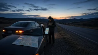
How to Find the Coordinates of a Breakdown Location in Google Maps

The Short Answer
Open Google Maps, wait for the blue dot that marks your current position, and then drop a pin on that spot. The app displays the pin's coordinates as two decimal numbers, latitude first and longitude second. Copy or read out both numbers exactly as shown, including any minus sign. Those two numbers are your absolute location: a precise point on the globe that does not depend on landmarks, road names or exit numbers.
An absolute location differs from a relative location such as "a mile past the gas station on the northbound side." A relative description helps a driver who already knows the area. Coordinates help anyone with a map find the point, even on unmarked rural roads, long highway stretches or roads with similar-sounding names. A complete breakdown report usually includes both.
Google updates the Maps interface regularly, so button names and menu positions can differ by app version, phone platform and settings. The steps below describe the general method rather than exact on-screen labels.
Getting Coordinates on an Android Phone
Open Google Maps and allow it to use your location if asked. Tap the location button so the map centers on the blue dot. Touch and hold the map directly on the blue dot until a red pin appears. Look in the search box or at the top of the information panel at the bottom of the screen. The coordinates are shown there. Tap the coordinates or use the share option to copy them or send them by text message.
Getting Coordinates on an iPhone
Open Google Maps and make sure location access is allowed for the app. Center the map on the blue dot. Touch and hold the map on the blue dot to drop a pin. Swipe up on the panel at the bottom of the screen to expand it. The coordinates are listed in the details. Copy the coordinates or use the share option to send them.
Getting Coordinates on a Computer
If someone at home is helping you, they can find coordinates in Google Maps in a browser by right-clicking a point on the map. The coordinates usually appear at the top of the menu, and clicking them copies them. A desktop browser generally does not know where your car is, so this method is mainly useful for confirming a location you have already described or shared.
How to Read and Share the Numbers Correctly
Google Maps shows coordinates in decimal degrees, with latitude first and longitude second, separated by a comma. The general format looks like this:
latitude, longitude; DD.DDDDDD, -DDD.DDDDDD
Latitude comes first. Swapping the two numbers points to a completely different place. In the continental United States, latitude is positive and longitude is negative because the country lies north of the equator and west of the prime meridian. Saying "minus" for the longitude matters. Dropping the sign moves the point to the other side of the world. Read every digit after the decimal point. Shortening the numbers reduces precision. When possible, send the coordinates as text instead of reading them aloud. Copy-and-paste avoids transcription errors. Google Maps may also show a Plus Code, which is a short letter-and-number code for the same spot. It can be useful, but many dispatchers and tow services expect standard latitude and longitude, so give the coordinates first.
What to Add Besides the Coordinates
Coordinates identify a point, but they do not say which side of a divided highway you are on, which lane you stopped in, or how a responder can reach you. Include these details where possible:
Road or highway name and number; Direction of travel, such as northbound or westbound; Nearest exit, mile marker, intersection or visible landmark; Whether the vehicle is on the shoulder, in a travel lane, on a ramp or off the road; Vehicle color, make and type, and whether hazard lights are on
If Your Location Does Not Appear or Looks Wrong
Check these causes in order, from most to least likely:
Location services are turned off for the phone. Turn them on in the phone settings. Google Maps does not have location permission. Allow location access for the app in settings. Precise location is disabled. On recent iPhone and Android versions, an approximate-location setting can place the dot far from your real position. Enable precise location for Google Maps. The phone has not yet received a good satellite fix. Wait briefly and move the phone to a spot with a clear view of the sky if it is safe to do so. Tall buildings, tunnels, deep valleys and dense tree cover can reduce accuracy. There is no mobile data. GPS positioning itself does not need a data connection, but the map may not load without data or a previously downloaded offline map. The blue dot can still appear, but surrounding roads may be missing.
The light-blue shaded circle around the blue dot shows how uncertain the position is. A small circle means a tighter fix. A large circle means your true position could be anywhere inside it. If the circle is large, mention this to the dispatcher and rely more on landmarks and mile markers.
Safety and Emergency Calls
If anyone is injured or the vehicle is stopped in a dangerous spot, call 911 first. Do not spend time collecting coordinates before you call. Emergency call systems may receive a location from your phone automatically, but how precise and available that location is depends on the carrier, the phone and the area. Give any coordinates you have as backup. Look up coordinates only when you and your passengers are in a safe position, away from moving traffic where possible.
Limits of This Guide
No source documentation for a specific Google Maps version or phone model was used for this guide. Menu names, gestures and the exact place the coordinates appear may differ on your device. Positioning accuracy depends on the phone's hardware, settings and conditions at the site, so this guide does not give a specific accuracy figure. If the steps above do not match your screen, check the help section inside the app for your current version.