Offline Maps for Car Navigation

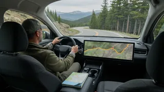
Drivers often plan routes through areas where cellular coverage drops, yet turn-by-turn guidance remains essential. Offline maps for car navigation solve that gap by storing road data on the device before a trip, allowing route calculation without a live connection. The phone’s GPS receiver continues tracking position even when data service is unavailable, while the saved map supplies the roads, addresses, and points of interest. This approach changes storage requirements, update habits, and how navigation behaves in remote regions. Understanding those differences helps a driver choose between cached map areas and a vehicle’s built-in system.
Essential answer
Offline maps for car navigation keep map information stored locally on a phone rather than streaming every tile over a mobile network. A driver selects and downloads a regional map while connected to Wi-Fi, then navigation apps can still compute routes and speak guidance without data. This makes the tool especially useful in mountains, rural highways, or areas where roaming charges and weak signal make streaming unreliable. The core function is not a separate GPS unit; it is the same navigation software operating from preserved local navigation data.
The practical benefit depends on how the map area was saved and whether the app has access to a current software version. GPS reception works independently, so the position marker moves normally, but live traffic or rerouting around a sudden closure may be unavailable without connectivity. Vehicle compatibility matters less than phone integration when using a mounted phone, while built-in systems have their own map update process. A saved offline area is best treated as a reliable base map, not a full replacement for connected services.