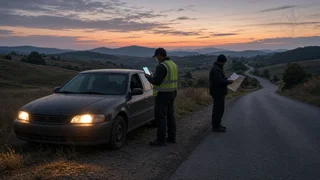
How to Check Your Location's Longitude and Latitude During a Roadside Breakdown
If your vehicle has broken down and someone needs to find you, your latitude and longitude give them a precise point to work from. The quickest way to get these coordinates is from your smartphone's map or compass app, which can show your current position as a pair of numbers. Some vehicle navigation systems can also display coordinates. This guide covers where to find the numbers, how to read them correctly, what limits their accuracy, and how to pass them on to a tow operator, roadside assistance provider or emergency dispatcher.
The Direct Answer
To check your location's longitude and latitude, open a map app on your phone and either tap the marker showing your current position or press and hold on that spot to drop a pin. Most major map apps then show the coordinates in the information panel or the search bar. On iPhones, the built-in Compass app typically shows coordinates near the bottom of the screen. Before you read the numbers out, confirm that location services are turned on and the app is allowed to use your precise location. Without those settings, the coordinates may be missing, out of date, or only approximate.
Latitude measures position north or south of the equator. Longitude measures position east or west of the prime meridian. Together they identify one point on the map. Latitude is conventionally given first, and reversing the two values points to a completely different place.
Where to Find Coordinates on Common Devices
Menus and labels change between app versions and operating system updates, so treat the following as general patterns rather than exact steps.
Smartphone map apps: Press and hold on your current location (usually a blue dot) to drop a pin. The coordinates often appear in the search field or in the details card that slides up. In some apps you need to scroll down within that card to see them. Phone compass app: Some built-in compass apps show latitude and longitude on the main screen once location access is granted. Shared location in messaging apps: Sending your current location through a messaging app passes your position as a map pin. The recipient can usually open it to see the exact point, even if you never read the coordinates yourself. Vehicle navigation or infotainment system: Some factory and aftermarket navigation units have a GPS status or position screen that shows coordinates. It is often found under navigation settings, system information or a diagnostic menu. Whether this screen exists, and where it is, depends on the make, model year, trim and software version, so check the owner's manual for your vehicle. Dedicated GPS units: Handheld and dash-mounted GPS devices usually have a position or satellite page showing coordinates, sometimes with an accuracy estimate.
Reading the Numbers Correctly
Coordinates can be written in several formats. All of them describe the same position, but mixing formats or dropping a sign can send help to the wrong place.
Format | How it looks | Notes; Decimal degrees | Latitude and longitude as single numbers with decimals | Most common in phone apps; a minus sign shows south or west; Degrees, minutes, seconds | Degrees, then minutes, then seconds, followed by N, S, E or W | Common on dedicated GPS units and some vehicle systems; Degrees and decimal minutes | Degrees, then minutes with decimals, followed by a direction letter | Used in marine, aviation and some outdoor devices
In the continental United States, latitude is north of the equator and longitude is west of the prime meridian. In decimal degrees, this means latitude is a positive number and longitude is a negative number. If you read coordinates aloud and leave out the minus sign on the longitude, the point moves to the other side of the world. When speaking to a dispatcher, say "north" and "west" or say "minus" clearly, and read every digit after the decimal point. The example below shows the structure of decimal-degree coordinates using placeholder digits, not a real location.
Latitude: DD.DDDDDD (positive = north); Longitude: -DDD.DDDDDD (negative = west); Spoken: "Latitude DD point DDDDDD north,; longitude DDD point DDDDDD west"
The number of decimal places matters. Rounding to one or two decimal places can shift the point considerably, possibly onto another road. Read or send the full value your app shows.
If Your Location Is Missing or Looks Wrong
If the app shows no coordinates, a large shaded circle around your position, or a point that doesn't match where you are, work through these checks in order:
Confirm location services are turned on in your phone's device settings. Check the location permissions for the specific app you are using. An app set to "never" or "ask next time" may not update your position. Turn on precise location if your phone offers it. Approximate location can place you somewhere within a wide area rather than on the exact roadside spot. Make sure airplane mode is off. Satellite positioning can work without cellular service, but many phones also use cell towers and Wi-Fi to get a faster, more reliable fix. Give the device time. After opening the app, wait briefly and watch whether the accuracy circle shrinks. Improve the view of the sky. Buildings, overpasses, tunnels, dense trees and steep terrain can block or reflect satellite signals. If it is safe to do so, holding the phone near a window, or stepping away from the vehicle to a safe spot clear of traffic, may help. Close and reopen the app, or restart the phone if the position still won't update.
Understanding Position Accuracy
Coordinates are only as good as the position fix behind them. Phones combine satellite signals with nearby Wi-Fi networks and cell towers. Accuracy depends on signal conditions, the device's hardware, and whether precise location is enabled. Many map apps draw a circle around your position to show uncertainty: a small circle means a tighter fix, and a large circle means the true location could be anywhere inside it.
Divided highways are a common problem. A slightly off fix can put you on the opposite carriageway, a frontage road or an overpass. Map data can also be out of date in areas with new construction or recently changed interchanges. For these reasons, coordinates work best alongside a plain description of where you are.
Giving Your Location to a Tow Service or Dispatcher
When you call for help, give the coordinates together with route information that a driver can confirm when they arrive:
Highway or road name and route number; Direction of travel, such as northbound or eastbound; Nearest mile marker, exit number or cross street; Recognizable landmarks, such as a bridge, rest area, business or distinctive sign; Which side of the road you are on, and whether you are on the shoulder, in a median or in a lane; Vehicle color, make and type, and whether hazard lights are on
Many roadside assistance apps and services can read your phone's location directly once you allow it. Emergency call systems in the US may also receive location information from your phone automatically, but how much detail reaches the dispatcher varies by carrier, device and local system. Don't assume the dispatcher already has an exact point. Be ready to state your coordinates and description if asked.
Some vehicles have a built-in connected-services or emergency button that sends the vehicle's position to a call center. Whether your vehicle has this, and whether the subscription is active, depends on the manufacturer, model year and market. Check your owner's documentation before you rely on it.
Before You Need It
It helps to practice finding your coordinates once while parked, so you know where the numbers appear in your preferred app. Keep the phone charged, carry a vehicle charger, and consider downloading offline map data for areas with poor coverage. Offline maps can still show your position from satellite signals even when cellular data is unavailable.