My Current Location Latitude and Longitude: How to Find and Share Your Coordinates at the Roadside
The direct answer
Your latitude and longitude come from the GPS (Global Positioning System) receiver in your phone or vehicle. No article or website can know them in advance, so you need to read them from your own device. On most smartphones this takes a few taps in a maps app or, on an iPhone, the built-in Compass app. Latitude is the north–south position and is always listed first. Longitude is the east–west position and comes second. Anywhere in the continental United States, latitude is a positive number and longitude is a negative number.
If you are stranded and in danger, call 911 first. Wireless 911 calls usually send the dispatcher an estimated location automatically. That estimate is not always precise, so be ready to read out your coordinates and your road details if you are asked.
How to find your coordinates on a phone
Menu names and layouts change between app and operating system versions. The steps below describe the general approach, not exact button labels.
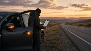
iPhone, Compass app: open Compass. Your coordinates appear near the bottom of the screen once location access is allowed. iPhone, Apple Maps: tap the blue dot that marks your position. In recent iOS versions, the information card that opens shows your coordinates. Android or iPhone, Google Maps: press and hold on the map at or next to the blue dot. A dropped pin appears, and its coordinates show in the search box or the information panel. Tap the coordinates to copy them. Any maps app: if the blue dot is a large shaded circle and not a tight point, your position is approximate. Wait a moment, or move to a spot with a clearer view of the sky.
Before you start, check that location services are turned on. If your phone lets you choose between precise and approximate location for each app, allow precise location for the maps app.
Finding coordinates on a vehicle display
Many factory navigation systems can show the current GPS position, often in a menu labeled something like "Where am I," position information, or GPS status. Whether this screen exists, and where it is, depends on the make, model year, trim and infotainment version. Some vehicles also have a connected-services or emergency button that sends the vehicle's location to a call center. Your owner's manual or the infotainment settings will tell you what your vehicle supports. A phone is usually the faster option.
Reading the numbers correctly
Coordinates are written in a few different formats. They all describe the same point, so read them out exactly as your device shows them and say which format they are in if you are unsure.
Format | How it looks | Notes; Decimal degrees | 39.12345, -98.12345 | Most common in phone apps. A minus sign means south latitude or west longitude. Degrees, minutes, seconds (DMS) | 39°7'24.4" N, 98°7'24.4" W | Letters N, S, E, W replace the plus and minus signs. Degrees and decimal minutes | 39°7.407' N, 98°7.407' W | Common on marine and aviation equipment and some navigation units.
The example values above are placeholders, not a real location.
Read latitude first, then longitude. Keep the minus sign on the longitude, or say "west." A US longitude without the minus sign points to a location on the other side of the world. Five decimal places in decimal degrees give a position to within roughly a meter. Four decimal places give roughly ten meters. Either is enough for a tow truck or responder to find you. Read digits one at a time, for example "thirty-nine point one two three four five."
Sharing your location after a breakdown
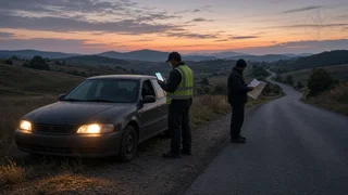
Coordinates are most useful when you combine them with road details a driver can see. Give a dispatcher, roadside assistance provider or tow operator as many of these as you can:
Latitude and longitude, read in order with the sign or direction letter; Highway or road name and your direction of travel; The nearest mile marker, exit number or cross street; Which side of the road you are on, and whether you are on the shoulder, in a lane or in the median; Your vehicle's color, type and any hazard lights or warning triangles you have set out
Most maps and messaging apps can also send a live or pinned location directly. This avoids reading errors when the recipient can receive it. Text-to-911 is available in many areas but not all, so a voice call remains the dependable option for emergencies.
When the location seems wrong or will not appear
Location services are off, or the app does not have location permission: turn them on in the phone's privacy or location settings. Poor sky view: tunnels, parking structures, deep cuts, tall buildings and dense tree cover can weaken or block GPS. Move to an open spot if it is safe to do so. No cell signal: the GPS receiver can still find your position without cellular data, and the iPhone Compass app shows coordinates offline. Maps may fail to load, though, and you will need a connection to send your location. Write the coordinates down so you can read them out once a call goes through. Stale position: if the dot has not moved after you have traveled, close and reopen the app, or toggle location services off and on. Low battery: GPS and screen use drain power. Note your coordinates once, then lower the screen brightness or turn on battery-saving mode while you wait.
Before you need it
Practice the steps on your own phone at home so you are not searching through menus at the roadside. If your vehicle has a navigation position screen or a connected emergency service, find out how it works ahead of time. Keep a car charger in the vehicle so your phone is available when you need to read or share your location.