8-Digit Grid Coordinates for Your Location: How to Find, Read and Share Them
The Short Answer
An 8-digit grid coordinate is a location written in the Military Grid Reference System (MGRS) or its civilian equivalent in the United States, the US National Grid (USNG). The eight digits pinpoint a 10-meter by 10-meter square. To get one for where you are, use a GPS device or smartphone app that can display MGRS or USNG, let it get a solid satellite fix, and read the full reference. That includes the grid zone designator and the two-letter square identifier, followed by the eight digits.
A complete reference looks like this, using made-up digits: 18S UJ 1234 5678. The first four digits are the easting (distance east) and the last four are the northing (distance north) inside the named 100-kilometer square. The eight digits alone do not identify a place. The same eight digits repeat in every 100-kilometer square, so always give the letters in front of them.
If the person you are calling does not use grid references, give latitude and longitude instead. Most 911 centers, roadside assistance services and towing dispatchers in the US work with latitude and longitude, road names, and mile markers. Grid coordinates are most useful when the receiver is set up to use them, such as search and rescue teams, some emergency management agencies, military units, and land-navigation or overland groups.
How the Reference Is Built
Every MGRS or USNG reference has three parts. You need all three for the location to be unambiguous.
Grid zone designator: a number and a letter, such as 18S. The number is the longitude band, called the UTM zone. The letter is the latitude band. 100,000-meter square identifier: two letters, such as UJ. They name a 100-kilometer square inside the zone. Numerical location: an even number of digits split evenly in half. With eight digits, the first four are the easting and the last four are the northing.
Read the coordinate right, then up. The easting tells you how far east you are from the west edge of the 100-kilometer square. The northing tells you how far north you are from its south edge. In an 8-digit reference, each half is measured in 10-meter steps.
What Different Digit Counts Mean
Total digits | Example format | Size of area described | Typical use; 4 | 18S UJ 12 56 | 1 km square | General area; 6 | 18S UJ 123 567 | 100 m square | Locating a vehicle along a stretch of road; 8 | 18S UJ 1234 5678 | 10 m square | Pinpointing a specific vehicle or person; 10 | 18S UJ 12345 67890 | 1 m square | Survey-level detail, often beyond what a phone can deliver
Grid references are shortened by dropping digits from the end of each half, not by rounding. To turn a 10-digit reading into 8 digits, drop the last digit of the easting and the last digit of the northing. For example, 12345 67890 becomes 1234 6789. This truncation keeps the reference pointing at the lower-left corner of the square that contains you.
Step by Step: Getting Your 8-Digit Grid Coordinate
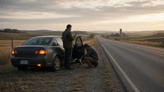
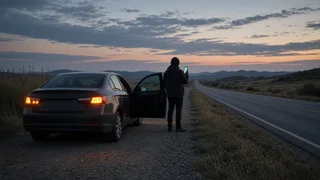
1) Get to a safe spot first. After a breakdown, stay in or beside the vehicle away from traffic, or behind a barrier if you can. Do not walk along a live roadway to improve your GPS signal. 2) Open a tool that shows MGRS or USNG. Options include a handheld GPS receiver, a dedicated MGRS or USNG app, a mapping or navigation app whose coordinate format can be switched to MGRS or USNG, or a land-navigation app. Many standard phone map apps show only latitude and longitude and need a separate app or converter. 3) Check the settings. Set the coordinate format to MGRS or USNG. If the app asks for a map datum, choose WGS 84 or NAD 83. For finding a vehicle at 10-meter precision, the difference between the two is generally negligible. Avoid older datums such as NAD 27, which can shift a position noticeably. 4) Wait for a good fix. Give the device time to lock onto satellites, ideally with a clear view of the sky. If the app shows an accuracy estimate, look at it. If the estimate is much larger than 10 meters, an 8-digit reference implies more precision than you really have. 5) Read the full reference. Write down the grid zone designator, the two-letter square identifier and the digits. If the app shows 10 digits, shorten each half by dropping its last digit to get 8. 6) Split the digits correctly. Put the first four digits in the easting group and the last four in the northing group. Say them as two groups so the listener does not mix them up. 7) Verify it. Enter the reference back into the same app or a converter and confirm it lands where you are. Alternatively, compare it with a latitude and longitude reading from your phone.
Recognizing a Grid Coordinate and Telling It Apart From Look-Alikes
Several location formats can show up on a phone screen, a GPS unit or a roadside sign. Here is how to tell a true MGRS or USNG reference from the others.
MGRS or USNG: starts with a number-letter zone such as 18S, then two letters, then an even number of digits, for example 18S UJ 1234 5678. Spaces may be missing, as in 18SUJ12345678. Latitude and longitude in decimal degrees: two signed decimal numbers. In the continental US, longitude appears as a negative number or with a W. Degrees, minutes and seconds: uses degree, minute and second symbols with N, S, E or W. UTM: a zone number plus long numeric easting and northing values in meters, with no two-letter square identifier. It is closely related to MGRS but not interchangeable with it unless converted. Word-based or proprietary location codes: words or alphanumeric codes from specific apps. They are not grid coordinates, and responders may not recognize them. Mile markers and emergency location markers: physical roadside or trail signs. In some areas, these markers display a USNG reference. Where they do, the printed reference can confirm or substitute for a device reading.
If you are unsure what format your device is showing, check its coordinate format setting rather than guessing. A reading with no two-letter square identifier is not an MGRS or USNG reference.
Giving Your Location During a Roadside Incident
Read the coordinate slowly and in groups. Use the phonetic alphabet for the letters to avoid confusion. For example, UJ becomes Uniform Juliet. Then give the easting and northing as separate groups of four digits. Ask the listener to read it back.
"Grid zone one-eight Sierra, square Uniform Juliet,; easting one-two-three-four, northing five-six-seven-eight."
Back up the coordinate with plain-language details. Include the road or highway name, direction of travel, nearest mile marker, exit or cross street, which side of the road you are on, and a description of the vehicle. Responders driving to you often find these details faster to act on than a coordinate. Combined with the coordinate, they make a wrong-location dispatch much less likely.
Limits and Common Mistakes
Leaving off the letters: eight digits without the zone and square identifier are ambiguous. Swapping easting and northing: always give easting first, then northing. Rounding instead of truncating: rounding can move the reference into a neighboring square. Trusting a weak fix: in tree cover, deep cuts, tunnels, parking structures or between tall buildings, a phone's position can drift well beyond 10 meters. Mismatched datum: a device set to an old datum can produce a reference that plots in the wrong place. Zone boundaries: near the edge of a grid zone or 100-kilometer square, a small move can change the letters. Read the full reference each time instead of reusing earlier letters. Assuming the receiver uses grids: if a dispatcher asks for latitude and longitude, give that instead. Most apps that show MGRS or USNG can switch formats.
Choosing the Right Next Step
If you are calling 911 or a roadside assistance service, lead with road details and latitude and longitude, and offer the grid coordinate if they can use it. If you are coordinating with search and rescue, a team that works from grid maps, or an off-road or overland group, the 8-digit MGRS or USNG reference is usually the clearest way to share a precise position. If you drive in remote areas often, set up a grid-capable app ahead of time and practice reading your own location. That way, you can get an accurate reference quickly when you actually need one.