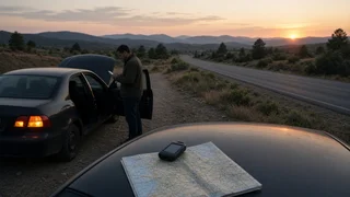
How to Find and Communicate Your GPS Coordinates After a Breakdown

The Short Answer
The quickest place to find your coordinates after a breakdown is usually your smartphone's map app. In most map apps, tapping the dot that marks your current position, or pressing and holding on the map at that spot, displays your latitude and longitude. Some vehicle navigation systems can also show coordinates, but whether yours does depends on the make, model year and equipment, so check the owner's manual.
Latitude is your position north or south of the equator. Longitude is your position east or west of the prime meridian. Together they identify a single point on the ground. Read latitude first, then longitude, and include any minus sign or direction letter. In the contiguous US, latitude is north and longitude is west, so in decimal format longitude appears as a negative number.
One condition matters most. Your phone can usually determine its position without a data connection, but you need some form of cell service to send or speak those coordinates. If you are in danger or anyone is hurt, call 911 first. Location tools are a supplement to that call, not a replacement for it.
Get to Safety Before You Look at a Screen
Finding coordinates only helps after you and your passengers are as safe as conditions allow. If the vehicle can still move, get it as far from traffic as you can. Turn on the hazard warning lights. Decide whether staying in the vehicle or moving to a protected spot away from traffic is safer in your situation. Do not stand between the vehicle and moving traffic to use your phone.
Where to Find Your Coordinates
Menus and button labels change between app versions and operating system updates. The locations below describe common patterns, not exact steps for every device. This guide was not checked against specific current app versions, so if a step doesn't match what you see, look for a similar option near your location marker.
Smartphone Map Apps
Google Maps: tap the blue dot showing your location, or press and hold on the map at your position to drop a pin. The coordinates usually appear in the search bar or in the information panel that opens. Apple Maps: tap your location marker, or press and hold to drop a pin, then open the details panel. Latitude and longitude are typically listed there. Other navigation apps: look for a dropped-pin, share-location or place-details option. Many of them show raw coordinates there.
Phone Compass and Built-In Tools
On iPhone, the built-in Compass app has commonly displayed latitude and longitude on its main screen. Some Android phones and third-party compass or GPS-status apps do the same. These tools can be useful when a map app is slow to load without data.
Vehicle Navigation and Connected Services
Some factory navigation systems have a position, location or GPS-information screen that shows coordinates. Others show only a street address or road name. Some vehicles also have a connected-services or emergency button that can send the vehicle's location to a call center. Whether your vehicle has either feature varies by brand, model year, trim, market and subscription status. The owner's manual or the manufacturer's connected-services documentation is the reliable source for your vehicle.
How to Recognize Coordinates and Avoid Look-Alikes
Coordinates appear as two numbers, and you need both. They usually come in one of the two formats below. Make sure you are reading your own position, not a destination, a searched place or the center of the map view.
Decimal degrees: latitude, longitude; e.g. DD.DDDDD, -DDD.DDDDD; Degrees-minutes-seconds: DD° MM' SS.S" N DDD° MM' SS.S" W
A street address, ZIP code or place name is not a coordinate. It may be accurate, but it is a different kind of location. A highway mile marker or exit number is helpful extra information, but it is not a coordinate. A dropped pin that you dragged away from your blue dot shows the pin's position, not yours. Some apps show alphanumeric location codes instead of latitude and longitude. Not every dispatcher or service accepts these, so give standard coordinates unless the service asks for something else.
Step-by-Step: Find, Check and Communicate Your Location
Before you start, you need a phone with location services turned on, enough battery to make a call, and ideally some cell signal. If location services are off, turn them on in your phone's settings. GPS can find your position without mobile data, but the first fix may take longer, especially if your view of the sky is blocked.
1) Make sure you are in the safest available position. If anyone is injured or the vehicle is in a dangerous spot, call 911 now and follow the dispatcher's instructions. 2) Open your map app and wait for the location marker to settle. A large shaded circle around the dot means the position is still uncertain. Moving toward open sky, away from overpasses, tunnels or dense tree cover, may improve it if that is safe to do. 3) Tap your location marker, or press and hold on it, to display the coordinates. 4) Copy the coordinates exactly, including any minus sign, decimal point or N/S/E/W letter. Take a screenshot as a backup. 5) Collect supporting details: road or highway name, direction of travel, nearest mile marker, exit or cross street, and visible landmarks. Add a short description of your vehicle, such as its color, type and location on the shoulder. 6) Communicate the location. On a voice call, say that you have GPS coordinates, then read latitude first and longitude second, digit by digit, including the decimal point and any minus sign or direction letter. In a message, paste both numbers together so neither gets lost. 7) Ask the person to read the coordinates back to you, and correct any mistakes. 8) If you can only send text, you can share coordinates or a location pin by SMS or a messaging app to a trusted contact or a roadside assistance provider that accepts them. Text-to-911 is not available everywhere in the US, so place a voice call to 911 whenever you can.
Completion Check
To confirm you have the right coordinates, paste them into the map app's search bar. The pin that appears should land on your actual position, on the correct side of the road. If it lands somewhere else, the numbers were most likely mistyped or the latitude and longitude were swapped. Re-copy them from your location marker.
Limits to Keep in Mind
Accuracy varies with your phone, its surroundings and signal conditions. A displayed coordinate is an estimate, not a guarantee, so always add road and landmark details. Wireless 911 calls in the US can carry location information to dispatch centers, but how precise and how available that information is varies. State your location out loud anyway. If you have no cell service at all, you can still note your coordinates, but you will need to reach a spot with signal, or use a satellite messaging feature if your device has one, before anyone can receive them. Coordinates show where you are, not how to reach you. On divided highways, ramps or parallel roads, your direction of travel and the nearest exit help responders approach from the correct side. Keep the phone's battery in mind. Lower the screen brightness, close unneeded apps and charge from the vehicle if it is safe to do so.
Gaps in This Guide
No specific source material was available for current app menus, individual vehicle navigation systems, connected-services features or regional 911 capabilities. Exact steps for your phone or vehicle should be confirmed in the device's or manufacturer's documentation. Check with your roadside assistance provider ahead of time to learn which location formats it accepts.