How to Use US 1 Mile Markers to Describe Your Breakdown Location
The Short Answer
If you break down on US 1, report the number on the nearest mile marker together with your direction of travel and the nearest town, island or landmark. For example: "US 1 southbound, just past mile marker 88, on Plantation Key, ocean side." A mile marker is a small roadside sign, usually green with white numbers, that shows distance along the highway. The number alone is not enough. US 1 runs through many states, and each state numbers its own section, so the same marker number can appear in more than one place along the route. The state, direction and a nearby place name tell responders which stretch of road you mean.
The Florida Keys are the one place where US 1 mile markers work as everyday addresses. On the Overseas Highway, the numbering starts at zero in Key West and rises as you head north toward the mainland. Businesses, emergency services and tow operators in the Keys commonly give locations by mile marker, often shortened to "MM."
How to Recognize a US 1 Mile Marker
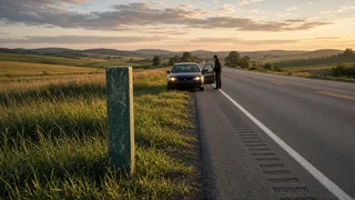
Mile markers are usually small vertical signs placed on the shoulder or median at regular intervals. Most are green with white numerals, though design and spacing vary by state. Some highways also have smaller intermediate markers between whole miles, showing tenths of a mile, which can narrow your location further.
Several roadside signs look similar, so make sure you are reading the right one:
Exit numbers: On limited-access highways, exits are often numbered by distance, but an exit sign marks an interchange, not your exact position. US 1 in many areas is an ordinary surface road without numbered exits. Route shields: The US 1 shield shows the route number, not a distance. Do not mistake the "1" for a marker reading. Street address numbers and cross-street signs: These are useful landmarks but follow a different system from highway mileage. Utility pole tags and bridge identification plates: These may carry numbers that responders cannot easily use. Report them only as extra detail.
If you are not sure whether a sign is a mile marker, describe what you see, such as "a small green sign with the number 92 on it." A dispatcher can then help you interpret it.
How US 1 Mile Markers Work in the Florida Keys
In the Keys, the mile marker system runs the full length of the Overseas Highway, from mile marker 0 in Key West to the mainland near Florida City, where the numbers reach the mid-120s. Lower numbers mean you are closer to Key West, and higher numbers mean you are closer to the mainland. Northbound traffic sees the numbers increase, and southbound traffic sees them decrease.
Locals also describe which side of the highway a place is on. "Bayside" or "Gulf side" means the side facing Florida Bay or the Gulf of Mexico. "Oceanside" means the side facing the Atlantic. On a two-lane stretch, adding the side tells a tow truck which shoulder to look for and whether it may need to turn around.
Plantation Key is a useful example. It is part of the Islamorada area in the Upper Keys and covers a short run of markers in the upper 80s to around 90. If you are stranded there, saying "Plantation Key" along with the closest marker number and side of the road gives responders a location they can reach without guesswork. The same approach works anywhere in the Keys: island name, marker number, direction and side.
Long bridges and undeveloped stretches have few landmarks, so the marker number is especially important there. If you are on a bridge, say so, and mention the bridge name if you know it.
Mile Markers on US 1 Outside the Keys
Beyond the Keys, US 1 continues up the East Coast to northern Maine. Mile marker systems on that route are set by each state, and some states also reset numbering at county lines or don't post markers on every stretch. Through cities, US 1 often becomes a regular street where markers may be absent entirely. In those areas, cross streets, business names and the city name are often more useful than a mile number. Report whatever marker you can see, but always pair it with the state and a nearby town or intersection.
Step-by-Step: Reporting Your Breakdown Location
No special equipment is needed beyond a working phone. A charged phone with location services turned on, hazard lights and, if you carry them, reflective triangles or a reflective vest all make the process safer.
1) Get to safety first. Move the vehicle as far onto the shoulder or into a pull-off as you safely can, and turn on the hazard lights. If the vehicle is in a travel lane, on a narrow bridge or anywhere you feel unsafe, call 911 before doing anything else. If you must leave the vehicle, exit on the side away from traffic, and only if it is safe to do so. 2) Note the last marker you passed. Drivers often notice markers without registering them. If you remember the last number you saw, that's a solid starting point, since you know you are just beyond it in your direction of travel. 3) Look for the nearest marker without walking along the roadway. If one is visible from a safe spot, read it. Do not walk along a highway shoulder or across lanes to reach a sign. An approximate location from the last marker you passed is far better than putting yourself at risk. 4) Confirm your direction of travel. State northbound or southbound. In the Keys, remember that northbound means toward the mainland and higher numbers. If you are unsure, the trend of the markers you passed tells you: increasing numbers mean northbound. 5) Add place context. Give the state and the nearest town, key, bridge, intersection or recognizable business. In the Keys, include bayside or oceanside. 6) Use your phone's location as a backup. A map app can show your coordinates or a dropped pin, and many roadside assistance apps can share your position. Give the mile marker description as well, because a responder approaching on the highway navigates by markers and landmarks. 7) Describe your vehicle. Give the color, make, body type and any trailer, so responders can pick you out on the shoulder. 8) Stay with the call until the location is confirmed. Let the dispatcher or roadside assistance agent repeat it back, and correct anything that is off.
A complete report can be short. A format like this covers everything a responder needs:
Road: US 1, Florida; Direction: Southbound; Marker: Just past mile marker 88; Place: Plantation Key, ocean side; Vehicle: Silver sedan on the right shoulder, hazards on
If You Can't See a Mile Marker
At night, in heavy rain or where signs are missing, you may not be able to read a marker. Give the last number you remember and roughly how long you drove after passing it, then share your phone's location. Describe anything distinctive nearby: a bridge, marina, gas station, shopping center, park entrance or the end of a causeway. When in doubt, describe what you can actually see rather than guessing a number. A wrong marker can send help to the wrong place.
Checking That Your Location Was Understood
Your report is complete when the person you called has repeated back the road, state, direction, marker number or nearest landmark, and your vehicle description, and you have confirmed it is correct. If you are calling a tow service or roadside assistance plan rather than emergency services, ask for an estimated arrival time and a callback number in case they cannot find you. If your situation becomes dangerous while you wait, such as smoke, fire, injury, or a vehicle stopped in a live lane, call 911 immediately.