How to Request a Stranded Driver's Location
When someone calls to say their car has broken down, the most useful thing you can do is get a location that a tow operator, roadside assistance provider or emergency dispatcher can act on without guessing. The fastest way to do that is usually to ask the driver to share their live location from their phone, then confirm it with a few details they can see, such as the road name, direction of travel and the nearest mile marker, exit or cross street. If the phone location is unavailable or looks wrong, fall back to those visible details. If anyone is hurt, the vehicle is in a dangerous spot, or the driver feels unsafe, they should call 911 first. Dispatchers have their own ways of locating callers, and finding the driver can wait.
What a Usable Breakdown Location Includes
A dot on a map is helpful, but responders also need to know how to reach the vehicle. On a divided highway, two points a few feet apart on a map can be on opposite sides of a barrier, and reaching the wrong side may mean driving miles to the next turnaround. When you ask how to find the driver, aim to collect these details:
Road or highway name and number, such as an interstate, U.S. route, state route or local street. Direction of travel, such as northbound or eastbound, or which city the driver was heading toward. The nearest mile marker, exit number or exit name, or the closest cross street on local roads. Which side of the road the vehicle is on: right shoulder, left or median shoulder, an off-ramp, or a parking lot. A shared live location or GPS coordinates from the driver's phone. Visible landmarks, such as a business sign, overpass, bridge, rest area or construction zone. A description of the vehicle: make, model, color, and whether hazard lights are on.
Step-by-Step: How to Ask for the Location
Step 1: Check that the driver is safe
Before asking about the location, ask whether anyone is injured and whether the vehicle is out of traffic. If the car is stopped in a travel lane, on a blind curve or anywhere the driver feels at risk, tell them to call 911. Usual safety advice is to turn on the hazard lights and either stay buckled in the vehicle or move well away from traffic, depending on conditions. Leave that choice to the driver, who can see the scene.
Step 2: Ask them to share their live location
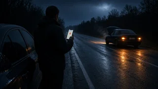
Most smartphones can share the device's current position through the built-in messaging or map apps. On iPhones, this is commonly done through the Messages app or the Find My app. On Android phones, Google Maps offers location sharing, and many messaging apps include a share-location option in their attachment menu. Menus change between software versions, so it is easier to ask the driver to open the conversation with you, tap the attachment or plus button, and look for a location option. A live or real-time share is better than a single snapshot, because it updates if the driver has to move.
Step 3: If sharing does not work, ask for coordinates
Coordinates are a pair of numbers, latitude and longitude, that pin a spot on Earth. Most map apps show them when the user taps and holds on their current-location dot, or in a details panel for a dropped pin. Some phones also show them in the compass app. Ask the driver to read the numbers slowly, including any minus sign, and write them down exactly. In the continental United States, longitude is written as a negative number in the decimal format most apps use. A missing minus sign can put the location on the other side of the world. Paste the coordinates into your own map app to check that they land on the road the driver described.
Step 4: Ask for visible road details
Even with a good phone location, ask what the driver can see. These questions work well in order:
What road or highway are you on? Which direction were you heading, or what was the last town or exit you passed? Can you see a mile marker, exit sign or street sign? What does it say? Are you on the right shoulder, in the median, on a ramp, or off the road entirely? What is near you: a bridge, overpass, gas station, business sign or construction?
Mile markers are the small numbered signs along the edge of many U.S. highways. On interstates they usually count up from a state's southern or western border, and in many states exit numbers match the nearest mile marker. Some states number exits in sequence instead. If the driver cannot see a marker, ask them to note the next one they see if they have to move, or the last one they remember passing.
Step 5: Read the location back and compare
Repeat the full location back to the driver in one sentence, for example: northbound on the interstate, right shoulder, just past a given mile marker, near a named overpass. Then compare it with the shared location or coordinates on your map. If the phone pin and the described details disagree, ask more questions before you send anyone. Common mismatches include the wrong direction of travel, a frontage road mistaken for the main highway, or a pin on a parallel road.
Step 6: Pass along the confirmed location
Give the tow company, roadside assistance service or dispatcher the confirmed details in the same order: road, direction, marker or cross street, side of the road, coordinates if available, and the vehicle description. Share the driver's callback number too. Let the driver know help has been requested, and ask them to call or message you if they move or their situation changes.
A Message You Can Send
If you are texting rather than talking, a short structured message gets better answers than an open question like "Where are you?"
Are you safe and out of traffic? If not, call 911 first. Please send me your live location from your phone. Also tell me: 1) Road or highway name; 2) Direction you were heading; 3) Nearest mile marker, exit, or cross street; 4) Which side of the road you are on; 5) Anything nearby (bridge, business, overpass)
Comparing Location Methods
Method | Strengths | Limitations; Live location sharing | Updates automatically, little effort for the driver, easy to open in a map app | Needs mobile data, location services and battery; accuracy depends on signal conditions; GPS coordinates | Precise when the phone has a good fix; works with any map app | Easy to misread or miss a minus sign; does not show direction of travel; Mile marker or exit | Matches how highway responders locate vehicles; needs no phone | The driver may not see a marker; does not cover local roads; Cross streets and landmarks | Works on city and rural roads; easy to understand | Can be vague; similar names may exist in nearby towns; Description of the route driven | Helpful when nothing else is available | Least precise; depends on the driver's memory
When the Phone Location Is Missing or Wrong
A shared location is only as good as the phone's position fix. Position accuracy can drop in deep valleys, dense cities with tall buildings, tunnels, heavy tree cover, or areas with weak cell coverage. Many apps show a shaded circle around the location dot. A large circle means the phone is unsure of its exact position. If the location will not share or looks clearly off, ask the driver to check a few device settings:
Location services are turned on for the phone as a whole. The messaging or map app has location permission, ideally set to allow precise location rather than an approximate area. Low-power or battery-saver modes are not limiting location updates. Mobile data is working, since sharing a location requires a connection even when GPS itself does not. The map app has had a moment to settle. Opening it and waiting briefly with a clear view of the sky can improve the fix.
If there is no data signal but the call still works, coordinates read aloud or visible road details are the best options. If the phone battery is low, ask for the essential details first and suggest the driver keep the phone for emergency calls rather than long troubleshooting.
When to Call 911 Instead
Finding the driver is not a substitute for emergency services. The driver, or you on their behalf if they cannot call, should contact 911 if there is an injury, a crash, smoke or fire, a vehicle stopped in a live traffic lane, or any situation where the driver feels threatened. Wireless 911 systems in the U.S. can often receive an estimate of the caller's location, but that estimate is not always exact. The dispatcher will still ask for road details, so the questions above remain useful. Many phones also have an emergency SOS feature that calls emergency services and can notify chosen contacts with the user's location. If the driver has set it up, it can be a quick way to get help and share their position at the same time.
Confirming You Have It Right
You have a usable location when three things line up. The shared pin or coordinates sit on the road the driver named. The direction of travel and side of the road are clear. A mile marker, exit, cross street or landmark confirms the spot. If any one of these is missing or conflicts with the others, ask one more question before sending help. A short extra exchange now is faster than a tow truck searching the wrong side of the highway.