Find a Reported Breakdown Location from Latitude and Longitude
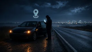
When a stranded driver, a roadside assistance app or a vehicle's connected-services system reports a breakdown as a pair of coordinates, you can turn those numbers into a place on a map in seconds. Paste or type the latitude and longitude into the search box of Google Maps or almost any other mapping app, and it will drop a pin at that point. The extra work is making sure the numbers are in a format the map understands, entered in the right order with the right signs, and accurate enough to send a tow truck or a friend to the correct side of the road.
The short answer
Enter latitude first, then longitude, separated by a comma, for example 40.7128, -74.0060. In the contiguous United States latitude is a positive number (north of the equator) and longitude is a negative number (west of the prime meridian). If the coordinates arrived in degrees, minutes and seconds (DMS), most mapping apps accept them as written, including the N and W letters. Once the pin appears, zoom in and compare it with the road, direction of travel and landmarks the caller described before relying on it.
Recognizing the coordinate format you were sent
Coordinates describe the same point in several notations. Identifying which one you have prevents most lookup errors. The same location written three ways:
Format | Example | How to recognize it; Decimal degrees (DD) | 40.7128, -74.0060 | Two numbers with decimals; a minus sign marks south or west; Degrees, minutes, seconds (DMS) | 40°42'46"N 74°0'22"W | Degree, minute and second symbols plus N/S and E/W letters; Degrees and decimal minutes (DDM) | 40°42.768'N 74°0.360'W | Degrees and minutes only, with minutes carrying decimals
Decimal degrees are the format phones and apps most often share. DMS is common on printed maps, older GPS units and some marine or aviation tools. Decimal minutes appear on many handheld GPS receivers. All three work in the major map apps, but mixing them, such as putting decimal minutes where whole minutes are expected, will move the pin.
How to find a location by latitude and longitude in Google Maps
On a computer, the process takes only a few steps:
Open Google Maps in a web browser. Click the search box at the top left. Type or paste the coordinates, latitude first, for example 40.7128, -74.0060 or 40°42'46"N 74°0'22"W. Press Enter. A red pin marks the point and the side panel shows the coordinates and, where available, a nearby address or road name. Zoom in and switch to satellite view to confirm the lane, shoulder, ramp or parking area.
In the Google Maps mobile app on Android or iPhone, tap the search bar, enter the coordinates the same way and tap search. From the pin you can tap Directions to generate route information to the breakdown, or share the pin with a tow operator or family member. The steps are essentially the same in Apple Maps, Waze and most other mapping apps, although menu names differ.
To go the other way and read coordinates off a map, right-click a spot in the desktop version of Google Maps; the decimal coordinates appear at the top of the menu and can be clicked to copy. In the mobile app, press and hold a spot to drop a pin, and the coordinates appear in the search bar or the information card. Exact behavior can change with app updates.
Other ways to check a location by coordinates online
If Google Maps is unavailable, you can find a location from lat and long online with other tools that accept the same input:
Other web and phone map apps, which generally accept decimal degrees and often DMS in the search field. Dedicated coordinate converter or GPS lookup websites, useful when you need to convert DMS to decimal or plot a point without an account. Some in-dash navigation systems, which allow entering a destination by coordinates, typically under a destination or advanced entry menu; availability depends on the vehicle make, model year and navigation software version. Roadside assistance and fleet dispatch apps, which often display a member's or driver's shared position on their own map.
Converting DMS to decimal degrees
If a tool only accepts decimal degrees, convert by dividing minutes by 60 and seconds by 3,600, then adding them to the degrees. Make the result negative for south latitudes or west longitudes.
Decimal = Degrees + (Minutes / 60) + (Seconds / 3600); Latitude 40°42'46"N -> 40 + 42/60 + 46/3600 = 40.71278; Longitude 74°0'22"W -> 74 + 0/60 + 22/3600 = 74.00611 -> -74.00611 (west)
For degrees and decimal minutes, divide the minutes by 60 and add to the degrees: 40°42.768' becomes 40 + 42.768/60, or 40.7128.
Mistakes that send help to the wrong place
Reversed order: entering longitude first can place the pin on another continent or in the ocean. Latitude always comes first in standard map searches. Missing minus sign: dropping the minus from a US longitude moves the point to the Eastern Hemisphere, often to Asia. Wrong hemisphere letter: confusing N with S or E with W has the same effect as a sign error. Comma used as a decimal separator: some regions write 40,7128; most map searches expect a period for decimals and a comma between the two numbers. Truncated digits: a reading cut down to two decimal places can be off by about a kilometer, enough to put the pin on the wrong road or interchange. Mixed formats: writing decimal minutes in a field meant for whole minutes, or adding seconds to a decimal-minute value, shifts the position. Typing errors: when reading coordinates aloud over the phone, ask the caller to repeat them, and read them back digit by digit.
How precise and accurate the reported position is
Two separate questions matter: how many decimal places were shared, and how accurate the device's fix was in the first place. The number of decimals limits the best possible precision. Each additional decimal place in decimal degrees is roughly ten times finer for latitude:
Decimal places | Approximate latitude resolution | Practical meaning for a breakdown; 2 | About 1.1 km | General area only; 3 | About 110 m | Stretch of road or a large lot; 4 | About 11 m | Close to the vehicle, side of road may be unclear; 5 | About 1.1 m | As fine as consumer GPS can meaningfully report
Longitude resolution becomes finer than these figures as you move away from the equator. Extra decimals do not make a position more accurate than the device that produced it. Position accuracy from a phone or vehicle depends on satellite visibility, tall buildings, tree cover, tunnels, overpasses, deep cuts in the terrain and whether the device is using GPS or a rougher network-based estimate. Many phones show an accuracy circle around the blue dot; a large circle means the reported coordinates should be treated as approximate.
Device settings also matter. If a phone's location services are off, set to approximate location, or the app sharing the position lacks location permissions, the coordinates may be stale, coarse or missing. If you are the one stranded, enable precise location for the map or roadside assistance app before sharing, and wait a moment outdoors or with a clear view of the sky for the position to settle.
Turning the pin into a usable recovery location
Map data shows where the point falls, but a tow operator or responder also needs context the coordinates alone cannot provide. Before dispatching or driving out, confirm these details with the driver where possible:
Highway or road name and direction of travel, since a divided highway's opposite carriageways can be only meters apart but far apart by road. Whether the vehicle is on the shoulder, in a lane, on a ramp, in a median or off the road entirely. Nearby mile markers, exit numbers, cross streets or businesses. Vehicle description: make, model, color and whether hazard lights are on. Any access issues, such as a low clearance, gated lot or soft ground, that affect the type of recovery vehicle needed.
Use satellite view and, where available, street-level imagery to check that the pin sits on a roadway that matches the description. If the route information from the map approaches from the wrong direction, plan the approach so the recovery vehicle arrives on the same side of the road as the disabled car.
Sharing your own coordinates after a breakdown
If you are the stranded driver, the quickest way to report your position is usually the share-location feature in your map app, which sends a pin the recipient can open directly. To read coordinates aloud, press and hold your blue location dot or drop a pin on it, then read the decimal numbers including any minus sign. Offer a landmark or mile marker as well, since a verbal description helps catch a misheard digit. In an emergency, call 911 first; dispatchers may receive location information from your phone, but stating your road, direction and nearest marker still helps.
Coordinates work the same outside the US
Latitude and longitude form a worldwide system, so the same method works for a breakdown reported in Oman, Europe or anywhere else. What changes is the sign: locations in the Eastern Hemisphere, including Oman, have positive longitudes, and locations south of the equator have negative latitudes. When coordinates come from a different country, pay extra attention to decimal separators and to whether the sender used DMS or decimal degrees, then confirm the pin against local road names before acting on it.